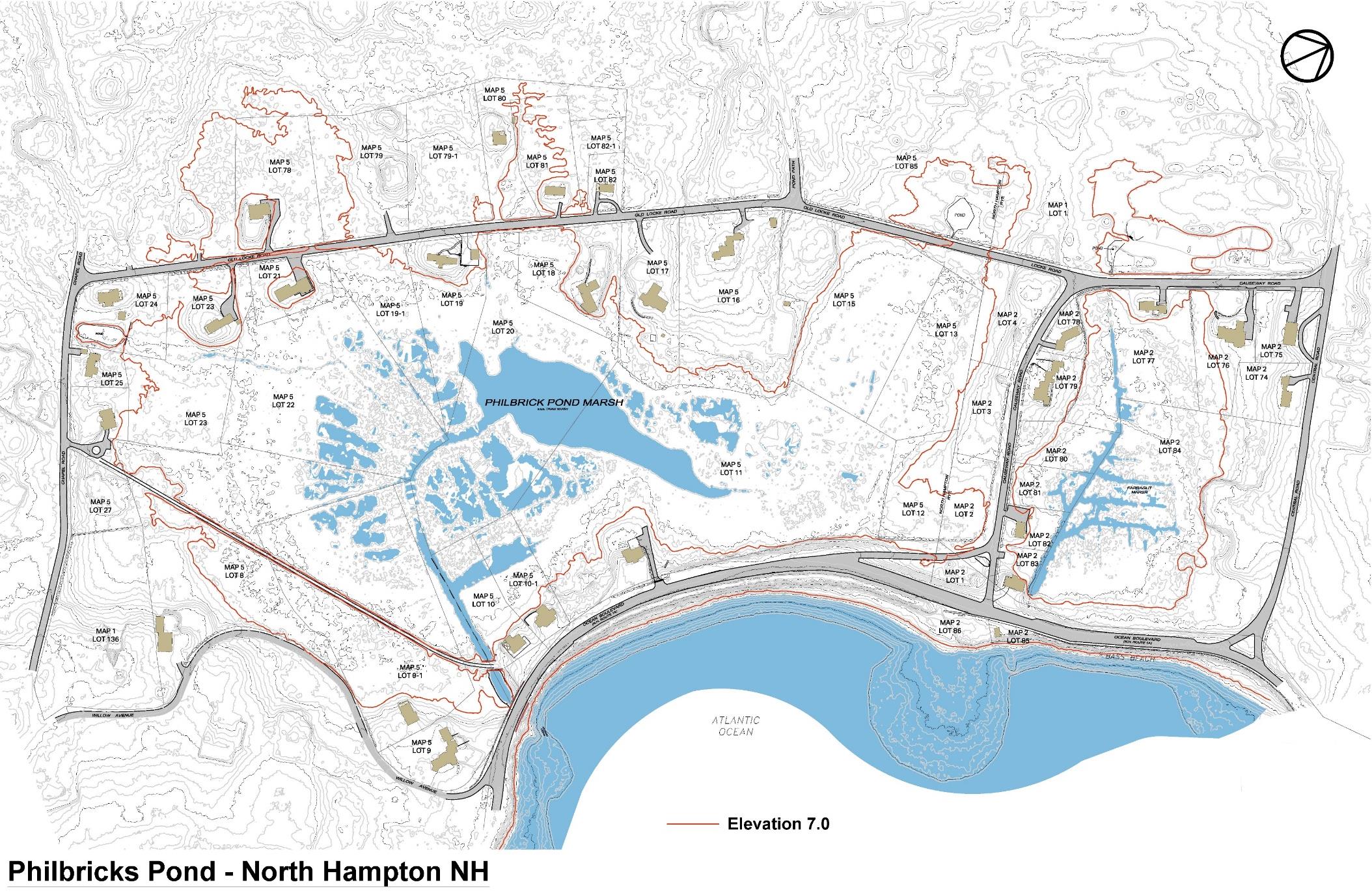
NORTH HAMPTON — In an attempt to find solutions to the Seacoast’s struggle with rising water levels, the draft report of the Philbrick Pond Salt Marsh Drainage Evaluation was recently released to the public.
The report was prepared by CMA Engineers among other contributors. The project’s mission was to survey the Philbrick Pond salt marsh, a 29-acre area along Route 1A, and determine possible recommendations to control high tide and storm surge flooding, as well as how to prevent an extreme 100-year storm from stranding the area’s residential neighborhoods.
The report also collected and analyzed data to find ways to improve the ecology and health of the salt marsh.
Water drains into the pond and marsh via two culverts below the roadway. One culvert is from a circa 1900 vintage trolley berm with a vitrified clay pipe, the other is a 48-inch diameter concrete pipe, the DOT culvert, which extends under Ocean Boulevard into the sea.
After evaluating extensive data on hydraulics, the effects on nature in the tidal marsh, and alternatives for drainage and flood prevention, the report suggested two possible solutions to consider.
One solution is to remove the cobble v-notch weir at the DOT culvert and replace it with a 4-foot wide concrete slab. This “slab” suggestion comes with a possible cost of $60,000. The report found this approach would improve the marsh’s health, without increasing flood risks.
The second solution for consideration is to improve roadway access in the neighborhoods. This would involve raising Old Locke Road or possibly building a new road from Bradley Lane to Woodland Road. Potential issues with this idea range from cost, a combined potential $700,000, and to land access, as it would involve cutting through several properties.
The salt marsh has long been an area of concern for residents, who had over 40 homes isolated by flood waters in the 2006 Mother’s Day storm. The result was a neighborhood with no access to vehicular traffic and emergency services for almost three days.
Craig Musselman, of CMA Engineers, commented at the public presentation that in “the grand scheme of things,” North Hampton is in a better position to weather sea level rise than neighboring Hampton and Rye.
The optimism of Musselman did not assuage fears from many residents of another 100-year storm, or of the ability of the town to adopt a plan that would ensure their safety and access to emergency services.
The final report will be presented to the Select Board and residents in August. There will be a full public hearing before any of the options presented would be acted upon, if any are at all.
Funding for the project came from the town and grants from the state Department of Environmental Services under the New Hampshire Coastal Program, as well as federal funds from the National Oceanic and Atmospheric Administration.
The entire 199 page draft of the Philbrick Pond Salt Marsh Drainage Evaluation report is available on the town of North Hampton website.
https://www.northhampton-nh.gov/sites/northhamptonnh/files/uploads/1028-philbrick_pond-dr-180816-salt_marsh_drainage_evaluation1-cnm_docx_draft_5-rs.pdf
 By Jesse Migneault / news@seacoastonline.com